Note: this page is only a draft, but this project is hosted on a public repository where anyone can contribute. Learn how to contribute in less than a minute.
Aerial photography (or airborne imagery)
Aerial photography (or airborne imagery) is the taking of photographs from an aircraft or other flying object. Platforms for aerial photography include fixed-wing aircraft, helicopters, unmanned aerial vehicles (UAVs or "drones"), balloons, blimps and dirigibles, rockets, pigeons, kites, parachutes, stand-alone telescoping and vehicle-mounted poles | Source: wikipedia.
Table of contents
Introduction
This type of imagery is usually used when we need more accurate/detailed data than satellite sensors data.
Resolution/accuracy can vary based on many factors as: sensor, height of the flight, weather, ...
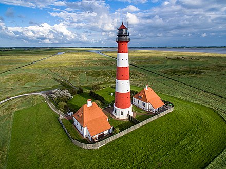
An aerial photograph using a drone of Westerheversand Lighthouse, Germany.
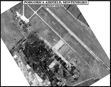
Air photo of a military target from an aircraft used to evaluate the effect of bombing:
Raster types
- ADS: Leica ADS40 and ADS100 airborne sensors
- Applanix
- Frame Camera
- ISAT
- MATCH-AT
- Table raster type to support digital cameras
- Scanned Aerial Imagery
- UAV/UAS
Data Providers
- Airbus....
Storage
Pending
Videos
Related topics
- Precision agriculture
- Lidar data: Detailed 3D representations generated by airborne or terrestrial laser scanning (commonly used to make high-resolution maps)
- ArcGIS Products:
- Drone2Map
- ArcMap and ArcGIS Pro
- ....