Note: this page is only a draft, but this project is hosted on a public repository where anyone can contribute. Learn how to contribute in less than a minute.
Raster data types
Rasters are digital aerial photographs, imagery from satellites, digital pictures, or even scanned maps.
Table of contents
- Introduction
- Raster data types
- Training
- Related products or technologies
- Other related list of resources
- Localized resources
Introduction
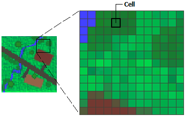
The raster model represents the surface of the earth as a grid of cells of equal size (square meter, square mile, ...) is usually used to represent continuous phenomena such us precipitation, elevation, heat from a forest fire, etc..
Each grid contains a discrete or continuous value. Examples:
- Discrete can have values that represent a code for a particular category. For example could be values defining the land type / land cover (1=backgound, 2=oak-pine, etc.)
- Continuous an elevation raster where each value define the altitude of that point
Learn more: What is raster data?
Raster data types could be classified in many different ways,
Number of spectral bands: sunlight consist of more wavelengths of electromagnetic radiation than the human eye can see (images are single band or multispectral)
- Single bands: grayscale imagery, DEM (Digital Elevation Model), 3D imagery (DTM and DSM)
- Multispectral: NaturalColor, color infrared, NDMI, NDVI, ...
Imagery sources (Sensor platforms):
- Satellites: Landsat, MODIS, Sentinel, WorldView, ...
- Aerial: aircrafts, helicopters, balloons, drones (UAVs), blimps and dirigibles, rockets, pigeons, kites, parachutes, ...
- Ground based: vehicle-mounted poles, stand-alone telescoping, handheld, ...
Sensor type used:
- Passive (record reflected sunlight): cameras, spectrometers
- Active (emit energy and record reflected radiation): Lidar, Radar, Sonar
Number of dimensions: unidimensional or multidimensional.
Use type: basemap, multispectral, temporal, event, elevation, ...
Raster data types
When we are working raster data types in a geographics information system we usually refers to four types:
- Aerial photography, aerial imagery or airborne imagery: photographs from an flying object (aircraft, helicopters, UAVs (or "drones"), etc.
- Satellite imagery (from satellite sensors)
- Multidimensional data: refers to data normally stored as variables, where each variable is a multidimensional array.
- Street-level imagery: photographs taken at street level.
But sometimes even about scanned maps.
Training
Getting started
Documentation and courses
Videos
We have created a Imagery Youtube playlist that we think it might be worth to you to save (how to save a Youtube Playlist).
On video.esri.com and Esri Events you will find many technical talks. Or check Esri Geodev channel for short videos.
And
| Event | Title | Length |
|---|---|---|
| DevSummit 2019 | Processing Drone Imagery using the ArcGIS API for Python | 55min 9secs |
| DevSummit 2019 | Using Deep Learning Models with ArcGIS to Extract Information from Imagery | 51min 20secs |
| DevSummit 2019 | Developing Imagery Apps using the ArcGIS API for JavaScript and WebApp Builder | 59min 44secs |
| FedGIS 2018 | ArcGIS Image Exploitation and Geospatial Analysis | 16min 55secs |
| DevSummit 2018 | Imagery and Raster Data in ArcGIS - An Introduction | 1h 10min 41secs |
| User Conference 2017 | Imagery Sources and Usage in ArcGIS | 1h 12min 45secs |
You might also find interesting videos at Esri Industries, ArcGIS, EsriTV, Esri R&D Center etc, and distributor's Youtube Channels
Slides
More slides in proceedings.esri.com or check on GeoNet.
Related products or technologies
There are several products you can use to work imagery content:
Other related list of resources
- awesome-satellite-imagery-datasets: List of satellite image training datasets with annotations for computer vision and deep learning
- awesome-satellite-imagery-competitions: List of machine learning competitions for satellite imagery and remote sensing.
- awesome-computer-vision: A curated list of awesome computer vision resources